Site plans cause more permit rejections than any other single sheet in the entire drawing set, and almost nobody explains what's actually supposed to be on one. You've learned you need a "permit set." You've heard "site plan" is one of the required sheets. What you probably haven't heard is that this one drawing, more than any other, decides whether your project gets approved on the first try or bounces back with a rejection before the building department even looks at your floor plan.
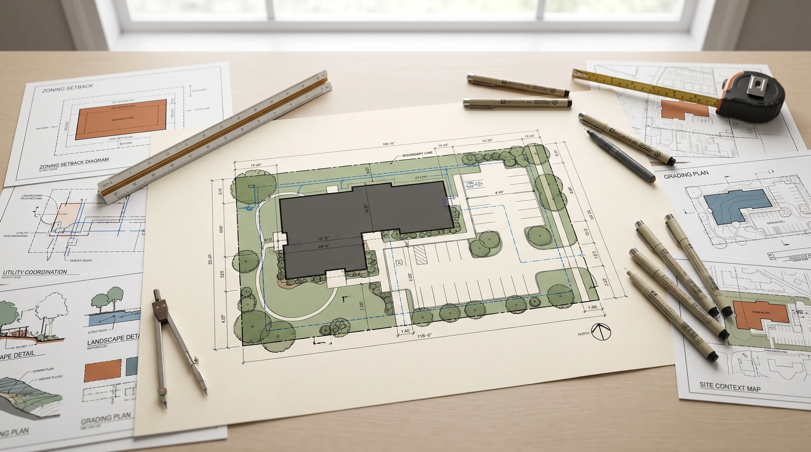
A site plan, also called a plot plan or site survey, is a bird's-eye-view drawing of your entire property: the lot boundaries, your existing structures, the new building or addition you're planning, the required distances (setbacks) from that structure to the property lines, any easements, and the utilities running through the property. It's the drawing building departments check first, because setback and zoning compliance get verified here before anyone looks at anything else. Here's exactly what's on one, why it's so easy to get wrong, and how to make sure yours doesn't come back rejected.
Below is a labeled example showing what a typical residential site plan includes.
Why site plans are so critical
Building departments review the site plan first, before the floor plan, before the elevations, before anything else, because setback violations are the single most common reason a permit gets rejected, and a setback violation makes everything else about the project irrelevant. If your proposed structure doesn't meet the required distance from the property line, it doesn't matter how well the floor plan is drawn. The project isn't compliant, full stop.
Here's a typical scenario: a homeowner plans a garage addition. The site plan shows it sitting 5 feet from the property line. The city's zoning code requires 10 feet minimum for that zone. Rejected, not because of a drafting error, but because nobody checked the actual requirement before designing. Now the homeowner is looking at a redesign, or a variance request that may or may not be granted. This happens constantly, in every building department, because the setback wasn't verified before the design process started rather than after.
What's actually on a site plan
Property boundaries. The exact perimeter of your lot, shown as thick lines defining its shape, with dimensions along each side. This defines the entire area you're legally allowed to build within. The common mistake here: using an old survey or rough measurements instead of current data. Property boundaries themselves don't move, but if your drawing shows the wrong boundary, every setback calculation built on top of it is wrong too.
Setbacks, the single most important element. The distances from your buildings to the property lines, shown as dimension lines with measurements. Requirements vary by zoning classification, but commonly run somewhere in the range of 15 to 50 feet depending on the zone and jurisdiction, confirm your specific number, don't assume. Zoning codes set these minimums to prevent overcrowding and preserve light, air, and neighborhood character. The common mistake: not verifying the actual required setback before designing, and instead building "close enough" to where an old structure used to sit.
Easements. Areas where a utility company or a neighbor has a legal right of access, shown as shaded zones or dashed lines labeled accordingly, a power line easement, a sewer line easement, a drainage or access easement. You cannot build in an easement, period; the utility company's or neighbor's legal access right overrides your construction plans. The common mistake: not checking for easements at all, then discovering mid-design (or worse, mid-construction) that a sewer line easement runs directly through the addition. That's a full stop, redesign, and real delay.
Utilities. Existing water, sewer, electric, and gas lines, typically shown with different line styles for each type. Your new structure needs to either connect to these or clearly route around them. Missing this on the site plan is a common, avoidable reason for rejection.
Existing structures. Your main house, garage, shed, deck, anything already built, shown as labeled, dimensioned shapes. This gives the plan checker spatial context and helps verify setback compliance for the new work relative to what's already there.
Proposed structure. The new building or addition itself, clearly marked as "proposed" or "new" and drawn in a different line style or color than existing structures, with dimensions showing its distance to each relevant property line. This is the actual thing being approved or rejected.
Dimensions and measurements. Every relevant distance, property lines, buildings, setbacks, shown as dimension lines with clear numbers. Missing or unclear dimensions are one of the most common, purely avoidable causes of rejection.
North arrow and scale. The compass orientation and the drawing's scale (commonly 1"=10', 20', or 30' depending on lot size). These seem minor, but a site plan missing either one routinely gets sent back for revision before a plan checker even evaluates the content.
Address and parcel number. Your street address and county parcel ID, identifying the property unambiguously, important in areas with multiple similar addresses or ongoing development nearby.
| Element | What it shows | Why it matters | Common mistake |
|---|---|---|---|
| Property boundaries | Exact lot perimeter | Defines your buildable area | Using an outdated survey |
| Setbacks | Distance to property lines | The #1 thing plan checkers verify | Not confirming the actual required distance |
| Easements | Utility/neighbor access rights | You legally cannot build here | Not checking for them at all |
| Utilities | Water, sewer, electric lines | Connections and routing | Omitting them from the drawing |
| Existing structures | Current buildings on the lot | Context for setback verification | Missing or undimensioned |
| Proposed structure | The new work | What's actually being approved | Not clearly differentiated from existing |
| Dimensions | All relevant distances | Lets the plan checker verify compliance | Missing or unclear numbers |
| North arrow/scale | Orientation and drawing scale | Required for the drawing to be usable | Forgetting to include it |
Site plan vs. floor plan
Both are "plans", top-down drawings, which is exactly why people mix them up. They're not the same thing, and they're not interchangeable.
| Site plan | Floor plan | |
|---|---|---|
| Shows | The property, entire lot, boundaries, surrounding context | The inside of the building, rooms, walls, doors |
| Perspective | Zoomed way out | Zoomed in |
| Focus | Setbacks, easements, zoning compliance | Room sizes, layout, interior flow |
| Typical scale | 1"=10'–30' | 1/4"=1' |
Simple way to remember it: the site plan shows where you're allowed to build on your lot. The floor plan shows how you arrange the rooms once you're building there.
What building departments check on a site plan
A plan checker reviewing your site plan is verifying:
- Property boundaries are accurate and match current county records
- The proposed structure meets required setbacks, the single biggest checkpoint
- No easements are being encroached on
- Utilities are shown and won't be impacted or blocked
- Drainage patterns are addressed, since new construction can change runoff
- A north arrow and stated scale are present
- All dimensions are clear, labeled, and accurate
- The address and parcel number are correct
- Existing and proposed structures are clearly distinguished from each other
Miss any one of these and the site plan comes back for revision, before the rest of your permit set gets a serious look.
Common site plan rejection reasons
| Rejection reason | What goes wrong | Typical cost to fix | Typical delay |
|---|---|---|---|
| Setback violation | Structure too close to a property line | May require a full redesign | 2–4 weeks |
| Easement encroachment | Structure placed in a utility or access easement | Utility relocation ($1,000–$10,000+) or redesign | 4–8 weeks |
| Inaccurate survey data | Boundaries don't match county records | New survey ($300–$1,000) plus redrawn plan | 1–2 weeks |
| Missing dimensions | Setback distances aren't clearly shown | Minor redraw ($200–$500) | About 1 week |
| Drainage not addressed | No grading/stormwater plan shown | Added drainage plan, possibly engineer input | 2–3 weeks |
| Utilities not shown | Existing lines aren't marked | Mark utilities on the plan ($100–$300) | About 1 week |
Notice the pattern: the two most expensive, slowest-to-fix rejections, setback violations and easement encroachments, are also the two most preventable, if the research happens before the design does rather than after a rejection forces it.
How to avoid site plan rejections
Get a current survey first. Before any drawing gets created, get a professional survey showing your property boundaries, easements, and utilities. Commonly $300–$1,000. A survey done up front is far cheaper than a redesign forced by a rejection later, this single step is the best money you'll spend on the entire project.
Verify your required setbacks. Call your city or county planning department and ask directly: "What are the minimum setbacks in my zoning classification?" Get the answer in writing if they'll provide it. Don't design based on where an old structure happened to sit, confirm the actual current requirement.
Check for easements. Review your property deed and a county parcel map, or call your county assessor's office if anything is unclear. Building in an easement isn't a matter of degree or negotiation, it simply won't be approved, whatever else about the design is right.
Hire a drafter or architect who does this research as standard practice, not as an afterthought. This is genuinely the most important prevention step of all, because it's the one that determines whether every item above actually gets checked before the drawings are finalized. Ask directly: "How do you start the site plan process, do you verify setbacks and easements with the city before you begin drawing?" A good answer describes jurisdiction research as step one, not a step they get to eventually. See Draftsman vs Architect: Which One Do You Actually Need? for the fuller picture of how to evaluate who you're hiring.
How to read a site plan
If you've received a site plan and want to check it yourself before it's submitted:
- Find the north arrow, it tells you the compass orientation of everything else on the sheet.
- Identify the property boundaries, the outer perimeter line.
- Locate your existing house, labeled as the existing structure.
- Find the proposed addition, labeled as proposed or new, typically in a different line style.
- Check the setback dimensions, the distances from the proposed structure to each property line, and compare them against your city's stated requirement.
- Look for any easements, usually labeled directly or shown as a shaded zone.
- Locate the utility lines, typically labeled sewer, water, or electric.
- Confirm every dimension is clear and legible.
If anything is missing, unclear, or doesn't match what you expected, ask before it gets submitted, a question now is faster than a rejection later. See What Drawings Do You Need for a Building Permit? for how the site plan fits into the rest of your permit set, and 7 Reasons Building Permits Get Rejected for the broader picture of what causes rejections beyond the site plan specifically.
FAQ
What is the difference between a site plan and a survey?
A survey is the underlying, precise measurement of your property's boundaries, typically performed by a licensed surveyor. A site plan is the drawing prepared for your permit set that uses that survey data, plus your proposed construction, setbacks, and other required information layered on top of it. You generally need accurate survey data to produce a reliable site plan.
How do I know what setback I need?
Call your city or county planning department directly and ask for the minimum setback requirements for your specific zoning classification. Requirements vary meaningfully by jurisdiction and even by zone within the same city, so don't assume based on a neighboring property.
What if an easement is in my way?
You generally cannot build within an easement. Depending on the situation, you may need to redesign around it, relocate a utility line (at real cost), or in some cases request the easement holder's approval, but this isn't guaranteed and shouldn't be assumed as your plan.
Do I need a professional survey?
For most permit applications, yes, building departments generally require current, accurate boundary data, and an old or informal measurement isn't sufficient. A survey commonly costs $300–$1,000 and is one of the best-value steps in the entire process.
What should a site plan include?
At minimum: property boundaries, existing structures, the proposed structure, setback dimensions, easements, utilities, a north arrow, a stated scale, and your address and parcel number. See What Is a Permit Set? for how this fits into the complete drawing set.
Why do building departments reject site plans?
Most commonly: setback violations, easement encroachments, inaccurate or outdated survey data, and missing dimensions. These account for the large majority of site plan rejections, and nearly all of them are preventable with research done before the drawing starts.
How do I read a site plan?
Start with the north arrow for orientation, identify the property boundary, locate existing and proposed structures, check setback dimensions against your city's requirements, and look for easements and utility lines. If anything's unclear, ask before submission.
Can I design my addition without a site plan?
No, a site plan is a required part of nearly every residential permit set, and it's typically the first thing reviewed. Skipping it isn't an option if you intend to get a legal permit.
Get it right the first time
The site plan is where more permits fail than anywhere else in the drawing set, and nearly every failure traces back to the same root cause: setbacks or easements that weren't verified before the design started. A current survey and a phone call to your planning department, done before anything gets drawn, prevents the overwhelming majority of these rejections.
If you're preparing a site plan for your project, we start with current survey data, verified setbacks, and easement research, before any drawing begins, not after a rejection forces it. Send us your property details and we'll prepare a site plan built to pass first-round review. Start with permit drawing services.